
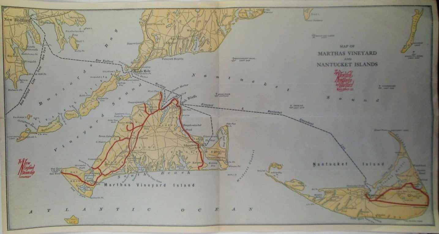
Map of Martha's Vineyard and Nantucket Islands. New York, New Haven and Hartford Railroad Co/The New England Steamship Company Map
No Place: New York, New Haven and Hartford Railroad Co., presumed Publisher. Unbound. Good. Item #018513
No place or date. Presumed early 1900s. Single sheet, roughly 17 by 10 inches. A map depicting the islands of Martha's Vineyard and Nantucket, with what appear to be railroad lines in red, as well as steamboat lines. Part of Cape Cod and New Bedford also depicted. The rail lines may be the narrow gauge lines that were in operation on the islands from the late 1800s to about 1917. May have been part of a travel booklet at some point GOOD condition. Horizontal and vertical fold crease present, with a few other small wrinkles and creases present. Light toning and soiling. A few minor tears along the edges.
Price: $55.00