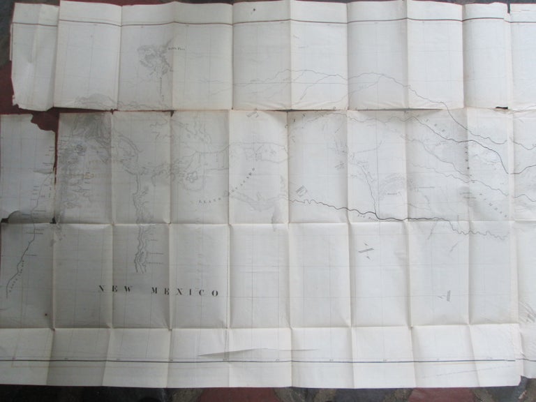
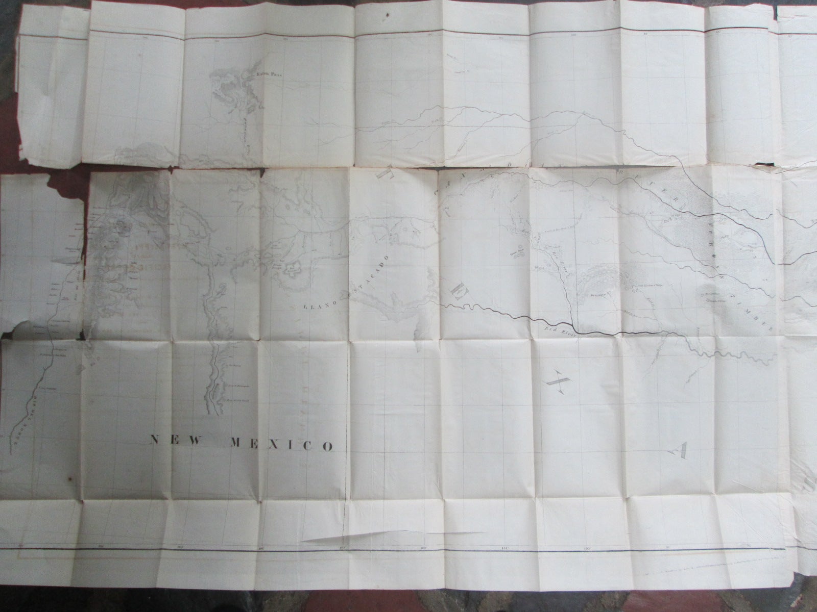
Map No. 1. Reconnaissance and Survey of a Railway Route From Mississippi River Near 35th Parallel North Lat. To Pacific Ocean. Made Under the Direction of the Secry of War By Lieut. A. W. Whipple, T. Eng. Assisted by Lieut J.C. Ives, 1853-54
No Place: No Publisher. Unbound. Poor. Item #013822
ISBN: noisbn
No publisher, place or date. Presumed US Government Printing Office, Washington DC, circa 1854. Single sheet folded many times, measuring approximately 81 by 30 inches. Printed on a single side only. A map showing the geography of a region of Central to Northwestern Texas and New Mexico, depicting the Canadian River, Red River, Arkansas River and Mississippi River (parts of each). With locations of Fort Washita, Fort Arbuckle, Shawnee Village and a Shawnee Town, Albuquerque, Santa Fe and many other settlements and towns. Presumably issued to accompany the government report of the surveys of this region. POOR condition. Very large horizontal TEAR along the upper fold crease, approximately 40 inches in length. Many other small tears along the folds, all, to some extent affecting the map. Tape repairs (by a previous owner) to many spots on the reverse. Minor uneven toning to the map. Some chipping, with a 3 inch area of loss, along the upper left edge, near Santa Fe, with the loss presumably in a blank section. Overall a somewhat worn and very fragile map.
Price: $125.00